
The first of the recently announced series of smaller maps sized DIN A1 (841 x 594 mm) is now available as digital edition. Classical Greece (DIN A1) is an excerpt of the larger map twice its size, focusing just on the core areas. While some areas had to be left out, the new version arguably uses the available canvas much more efficiently, with much less space devoted to the open sea. Thus despite being half the size, it still includes most of the content.
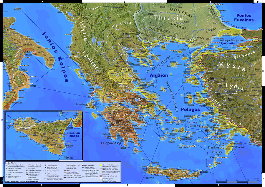
The new excerpt of my big map of Classical Greece. Half the size, but still includes most settlements.
One may immediately notice the asymmetrical alpha numerical grid, with the number 2 appearing two times on the right side but only one time on the left. The reasons become clear once we look at the map below with some lines of equal degrees longitude and latitude shown.

The map with some meridians and circles of latitude drawn
When making a map a section of the surface of an three dimensional sphere has to be projected on a two dimensional flat plain. For one depicting only a relatively small section of Earth's surface, like in this instance Greece, this is best done by using the Universal Transverse Mercator (UTM) projection. Here the surface of Earth is divided into 60 zones. For each a transvese mercator projection with different parameters is done. Within each zone there are almost no distortions. However, needless to say that this method is ill suited if a map would span from west to east across multiple zones. For the ancient Greece map UTM Zone 34N is used.
An UTM projection results in a cartesian coordinate system with coordinates that look unfamiliar for a general audience accustomed to the global system of longitude and latitude, which is thus used for the grid of my maps.
Since the meridians and circles of latitude are not parallel to the axes of the Cartesian UTM coordinate system and a new section of the zebra grid is drawn whenever one of them intersects the border of the map canvas, it is not always possible to have prefect looking grid and the optimal extend of the map area, as shown above.
Next in line is the downsized version of Imperium Romanum 211 AD later this month. In print it is already available as part of the double sided poster The World of Ancient Rome. Ancient Persia will follow towards spring and lastly the new Ancient World/Old World map, showing most of Eurasia and Africa, probably in early summer.
Write a comment