
Dawn of the Classical World
A second huge wall map made for Sardis Verlag, depicting the Mediterranean and the Persian Empire about the year 500 BCE. Unsurpassed in the number of covered cultures and total area. The map was also sold by Sardis Verlag as The Achaemenid Empire and the West and Giant Wall Map of the Persian Empire.

Detailed wall map of the ancient world at the transition between the archaic and classical periods of Mediterranean civilization. The map encompasses the entire territory between the Pillars of Hercules and the Indus valley, between the Hallstatt era Celts in what is now southern Germany and eastern France and the legendary kingdom of Saba in southern Arabia. This includes the Achaemenid Persian Empire at its greatest extend during the reign of Dareios I., 522 – 486 BCE.
Features:
- The Ecumene, the world known for the ancient Greeks at the turn of the 6th to 5th century BCE
- All great nations and cultures of their period,
- The colonies of the Greeks and Phoenicans,
- All countries of the Persian Empire with their respective capitals,
- The territories of Herodot's 20 satrapies,
- More than 1000 settlements and sanctuaries,
- More than 250 peoples and regions,
- The Persian royal road network,
- Caravan and trade routes,
- Major sea routes,
-
Modified geodata to reflect the ancient topography,
- Detailed ancillary map for southern Etruria and old Latium during the first years of the Roman Republic,
- Legend in English and German,
- DIN A0 (118,9 x 84,1 cm),
- Scale: main map 1:5.000.000, ancillary map 1:900.000.
HD prints or Downloads of this map can be purchased from my online store. A number of posters based on the previous edition from 2019 are currently also still available.


Commentary
The main map is in 1:5 million scale. An Albers equal-area conic projection was chosen to deal with the large east to west extension of the our area of interest, which spans from the pillars of
Hercules and the Atlantic sea all the way to the Indus river. The reference meridian is 12° East, the standard parallels are 20° and 45° North. Despite these efforts it became necessary to add
two inlay maps for the western Mediterranean.
Just as for the Roman Empire map the background is composed from landclass and bathymetry data from Natural Earth, with a shaded relief calculated from the 1 km resolution SRTM30 data set provided by the
U.S. Geological Survey. At some places the coastline has
changed significantly since ancient times. There, the geodata was accordingly modified, also some relevant rivers have been added or adopted.
While the previously released Roman Empire map depicted a fixed point in time, I followed a broader approach here. It was my intention to make the map represent an entire era, while
simultaneously having to cope with less precise and plentiful source material. As an orientation, I used the long reign of Darius I. between 522 and 486 BCE, when his Achaemenid Empire had
reached its greatest extent.
Names: The multitude of peoples and cultures that greatly contribute to this epochs fascination can also be a bane for the modern cartographer who
wishes to make a consistently labeled and easily understandable map. Int the Roman Empire a unified Koine Greek was the dominant language in the east and Latin in the west, which was also used
for official purposes the entire empire. In the early 5th century BCE however, no language had any comparable significance in the displayed area. The Greek world was divided into various partly
quite different dialects. Thus the name of the nymph and city of Kyrene becomes Kurana in its native Doric. Even the Achaemenid Empire had no single official language. The bureaucracy mainly used
Elamite, but also old Persian, the Royal inscriptions were at least recorded trilingually in Old Persian, Elamite and Akkadian, add to this a multitude of local languages and Aramaic especially
for communication.
Additionally the names of many settlements are only recorded by much later authors, or in earlier sources as the Assyrian annals. Even for modern names coming from Arabic or Persian there is now
common transliteration into our Latin script.
All those points mean that the reader will find names from many different languages to be used on our map. I attempted to make it as easily comprehensible as possible, thus more common form of
names in Greek or Latin are often preferred to native ones. In some cases both versions are given. For the great Etruscan metropolises the local name is used on the main map, while the Latium
Vetus inlay map is kept completely with Latin labels.
Cultures: I used different colors to differentiate the settlements of some of most important cultures on the map. The purpose was to make that widely
distributed Greek and Phoenican colonies easily recognizable. However in many cases such a simple system can not able to display the complex realities of many cities in cultural border zones. For
example many Carian, Lycian or Pamhylian cities of this time already possessed very strong Greek elements while still keeping their indigenous traditions and languages alive.
Quality of Sources: Compared to its at least equally important central Asiatic parts the western half of the Achaemenid empire is much better attested,
both through ancient (Greek) sources and more intense archaeological research in this parts of the world. Only with the campaigns of Alexander the Great in the late 4th century BCE full accounts
that allow us to get a clear picture of the eastern satrapies at one point in time become available. Data quality is also very uneven for their capitals. For Dahan-i Ḡhulāmān or Daskyleion we
have undoubted archaeological or literal evidence, while for Arachosia just a single Elamite tablets from the alter town walls of Kandahar hints at its importance in the Achaemenid era. For
Damascus a note from the geographer Strabo (Book 16.2.20), writing during the age of Augustus, makes us to assume that the city served once as the capital of Ebir-Nari.
Royal Roads: The Persian Royal Roads, the routes served by the royal postal service (Pirradaziš), are subdivided into two categories, that are either
to some degree backed by evidence are have to be assumed to link some administrative center to the capital. Generally even for the most of the former routes the available evidence, such as the
Persepolis tablets, allows us only to firmly reconstruct their origin and destination. The exact path however is mostly just speculative.
Satrapies: During the early expansive phase of the Persian Empire annexed states were directly incorporated and preserved as primary administrative
units, including their internal system of governance.
The grand combined satrapy of Athura and Ebir-Nari with its capital Babylon that still existed during Darius reign essentially was the former Babylonian Empire minus its Arabian territories who
had been quasi independent allies during that time. As the Empire grew older the large satrapies were further divided into smaller units.
The map shows two sets of provinces for the Achaemenid Empire. The first one is Herodotus classical list of 20 satrapies (Hist. 3.89) whose creation was attributed by him to Darius. Their numbers on the map are
directly taken from Herodotus. The accuracy and general credibility is quite often doubted by modern scholars, but since this division is often quoted and discussed I considered it
essential.
The second, more pronounced, set is based on Darius dahyâva lists from his Royal Inscriptions. Their exact composition is not uniform, the Greeks, for example, are sometimes subdivided into
various categories, like those who dwell on the islands/ on the sea, or Greeks who wore sunhats (Macedonians). Often the dahyâva lists are called lists of satrapies in literature, but it should
be kept in mind that their purpose was to transmit an idealistic image of the Empire for propaganda purposes, not administrative details to later generations.
Borders: Because of the scarcity of sources some scholars question the usefulness of the very attempt to draw boundaries of Achaemenid administrative
units. Also the inherent flexibility of the empires organization should be taken into account, overlapping spheres of influence of persons and levels of bureaucracy, not identical with fixed
territorial units.
The same can be said about the outer borders of Achaemenid Persia, which reflect the limits of the kings direct influence. Especially for the numerous tribes of horse or camel herding nomads
along the fringes of settled land the perception about their formal incorporation into the Achaemenid realm, the offered gifts and demonstrations of loyalty, could be quite differently perceived
or portrayed from both sides.
Despite these points in some cases borders can be drawn with some confidence. The limits of Ebir-Nari are quite well defined by the Euphrates river, the mountains to Cilicia or archaeological
research about the most likely extension of Qedarite rule in the south. To help the reader to get a quick and easily interpretable overview of the Achaemenid empire and its countries I added the
boundaries described above. All borders are intentionally kept in a diffusive style. One should always be aware that they not have the same absoluteness as borders in Roman Empire or even modern
states.
Red Sea Region
So far not much is known about the supposed polity D’MT, variously vocalized as Di‘amat, Da‘amat or Damot, which is attested only by a small number of inscriptions. Its chronology, politics and relationship with the contemporary Sabaean Empire remain obscure. Even if D’MT was indeed the name of a kingdom or just for the indigenous population is still a matter of debate. The local culture was heavily influenced by southern Arabia on all fields and evidently a component of native Sabaeans was present in the country. But nevertheless distinct African elements remained and the large majority of the population remained of African descent.
Etruria et Latium Vetus
Due to the later dominance of Rome even this early era of Roman history is well covered by ancient sources. However these accounts were all composed several centuries after the described events.
The early historians of the Rome and their Greek counterparts tried to reconstruct a coherent narrative of Rome's first centuries out of the evidence still available to them. For the modern
historians, which have much less material to work with, it has become barely possible in many ways to judge the accuracy of their ancient predecessors.
Archaeology too can only partially help to unravel the first centuries of the Roman state. Excavations did show that archaic Rome was a wealthy city state which could effort to construct numerous
monumental public buildings. Its limits however are revealed if we look for the boundaries of Rome's power and her internal organization.
An important document to answer this question is the first treaty between Rome and Carthage, which was only passed to us in Greek translation by Polybios (Book 3.22), a historian writing in the mid 2nd century BCE. Polybios dates the treaty to the first years of the Republic, for many a doubtful date. A crucial argument for the authenticity of this document is Polybios remark that the archaic Latin could barely be understood by contemporary Romans, which fits well into what we know about early Latin and its development in the first centuries of the Republic Latin from texts and inscriptions, such as the stele from the Lapis Niger or parts of the Law of the Twelve Tables which kept their original wording.

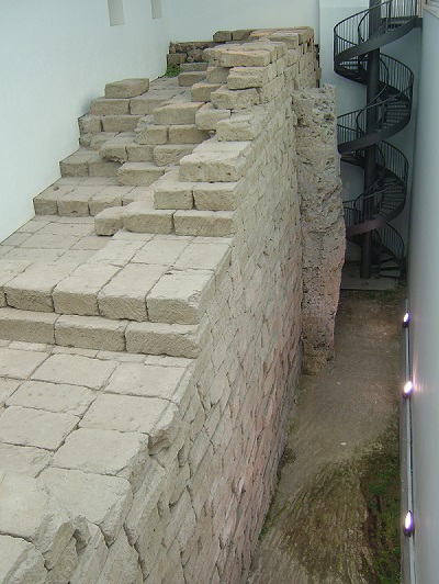
Stele from the Lapis Niger, featuring one of the oldest known Latin inscriptions,
Museo Nazionale Romano - Terme di diocleziano (Photo: Author).
The Pontine Plain: To the south east Latium is bordering the extended marshes of the Pontine Plain, which was also called Pomptinae Paludes (Pontine marshes, or swamps) by Roman authors since the late Republic. They formed in place of an ancient lagoon, filled with sediments and plagued by a poor drainage towards the sea due to the dune belt between Terracina and Circeii. Only in the 1930s the marshes could be finally reclaimed and converted to farm land.
Even in quite recent literature authors often assume that the 6th and 5th century BCE Pontine Plain was a mostly drained and highly productive center of settlement. Such as Linoli (Linoli 2009): „During the seventh and sixth centuries BCE, the Latins and Volscians founded numerous settlements in the area, consequently managing to control the waters (even partially), but with Roman occupation, the area declined. The Volsci were the first to undertake drainage works in the Pontine areas they inhabited, and to exploit the fertile lands for farming purposes... At that time therefore, the marshes – thanks to the works carried out by the Volsci – must have been limited to localised areas lying lower than sea level“.
It is mandatory for this hypothesis that the Volsci, a people who just begun to emigrate from the interior to the coastal regions in the late 6th century, were already masters in the art of drainage.
However, in recent years new archaeological field work (Attema 2014), (de Haas 2011) has shown that this case has to be rethought. According to their finds the core parts of the region at this time were an uninhabited marshland, used only seasonally by transhumance herdsmen. During the 5th century, when all of Latium was plagued by crises and wars the existing settlements declined.
Only with the construction of the Via Appia and the parallel Decennovium canal an era of colonization and reclamation begun. Agricultural use of the Pontine Plain peaked during the middle Republic, the 3rd and 2nd centuries BCE. Only in the centuries before and after the turn of the eras many settlements were slowly abandoned and the marshes mentioned by contemporary sources returned.
Bibliography
The literature consulted by me when making the Dawn of the Classical World map. For better readability, the list of sources is separated by topic into sections. We begin with a list of more general topics, then continue with three geographical subdivisions: the entire Achaemenid Empire, the Mediterranean Basin and Europe and finally Southern Arabia and Interior of Africa.
Primary Sources
- Herodotus (ca. 484 - 425 BCE): Histories
- Xenophon (ca. 430 - 354 BCE): Anabasis
- Arrian (ca. 85–90 - 145/146 CE): The Anabasis of Alexander, Indica
General
- BOARDMAN 1982: J. Boardman, N.G.L. Hammond (eds.), The Cambridge Ancient History 2nd edition Volume 3.3. The Expansion of the Greek World, Eighth to Sixth Centuries B.C., Seventh Printing, Cambridge University Press (2006).
- BOARDMAN 1988: J. Boardman, N.G.L. Hammond, D.M.Lewis, M. Ostwald (eds.), The Cambridge Ancient History 2nd edition Volume 4. Persia, Greece and the Western Mediterranean C. 525 to 479 B.C., Sixth Printing, Cambridge University Press (2006).
- CASSON 1995: L. Casson, Ships and Seamanship in the ancient world, Johns Hopkins University Press (1995).
- ENCIR: E. Yarshater (ed.) et Al., Encyclopaedia Iranica, iranicaonline.org.
- HANSEN 2005: M. H. Hansen, Th. H. Nielsen, An Inventory of Archaic and Classical Poleis. An Investigation Conducted by The Copenhagen Polis Centre for the Danish National Research Foundation, Oxford University Press, (2005).
- PLEIADES: B. Turner, T. Elliott et. Al., Pleiades - A community-built gazetteer and graph of ancient places, pleiades.stoa.org
- ROHDE 2016: D. Rohde, Dorothea, M. Sommer, Wirtschaft, Geschichte in Quellen - Antike, wbg Academic (2016).
- STILLWELL 1976: R. Stillwell, W. L. MacDonald, L. William, M. H. McAlister, The Princeton encyclopedia of classical sites, N.J. Princeton University Press (1976).
- TALBERT 2000: R.J.A. Talbert (ed.), Barrington Atlas of the Greek and Roman World, Princeton University Press (2000).
- TAVO, Tübinger Atlas des Vorderen Orients, Dr. Ludwig Reichert Verlag (1975-1993).
- TOPOSTEXT: B. Kiesling (ed.), Topostext - An indexed collection of ancient texts and mapped places relevant to the history and mythology of the ancient Greeks, https://topostext.org
- WBG 2024: M. Blömer, A. Lichtenberger (eds.), Erhaben und den Göttern nahe - "Heilige Berge" der Antike, wbg Philipp von Zabern, Verlag Herder (2024).
- WITTKE 2007: Anne-Maria Wittke, Eckart Olshausen, Richard Szydlak, Der neue Pauly. Historischer Atlas der antiken Welt, Metzler (2007).
Geodata
- Shaded relief calculated from SRTM30 dataset. Source: U.S. Geological Survey, U.S. Geological Survey, usgs.gov.
- Original coastlines, bathymetry and landclass: naturalearthdata.com
Achaemenid Empire
- AALI 2012: A. Aali, A. Abar, N. Boenke, M. Pollard, F. Rühli, T. Stöllner, Ancient salt mining and salt men: the interdisciplinary Chehrabad Douzlakh project in north-western Iran, Antiquity Volume 86 Issue 333 (2012).
- AINSLIE 2008: R. Ainslie, S. Usher-Wilson, M. Ershadi, Gorgan Wall IRAN - Qaleh Kharabeh, Tokhmagh Tappeh, Dasht Qualeh, Ghelich Ghoynech - Geophysical Surveys using Magnetometery, Abingdon Archaeological Geophysics, archaeologicalgeophysics.co.uk, (2008).
- ALVAREZ-MON 2018: J. Álvarez-Mon, G. P. Basello, Y. Wicks (eds.), The Elamite World, Routledge World No. 16, Routledge(2018).
- ANDERSON 2010: B. Anderson, Achaemenid Arabia: A Landscape-Oriented Model of Cultural Interaction, in J. Curtis, St.J. Simpson (eds.), The World of Achaemenid Persia: History, Art and Society in Iran and the Ancient Near East, I. B. Tauris (2010), 445-456.
- BADALYAN 2010: R. Badalyan, A. T Smith, L. Khatchadourian, Project aragats: 10 years of investigations into Bronze and Iron age sites in the Tsaghkahovit Plain, Republic of Armenia, TUBA-AR 13/2010, 263-276.
- BALL 2019: W. Ball, Archaeological Gazetteer of Afghanistan: Revised Edition, Oxford University Press (2019).
- BASAFA 2021: H. Basafa, M. Sadegh Davari, A New Perspective on the Archaeology of the Khorasan Region during the Iron Age, Iranian Journal of Archaeological Studies Vol. 11, No. 1 (2021), 41-53.
- BAUMER 2012: C. Baumer, The History of Central Asia: The Age of the Steppe Warriors, Volume 1, Bloombsbury Publishing (2012).
- \item
- BEAULIEU 2018: P.-A. Beaulieu, A History of Babylon, 2200 BC - AD 75, Blackwell History of the Ancient World, John Wiley and Sons Ltd (2018).
- BLM 2021: Badisches Landesmuseum Karlsruhe (Hrsg.), Die Perser – Am Hof der Großkönige, Wissenschaftliche Buchgesellschaft (WBG) (2021).
- BONACOSSI 2020, D. M. Bonacossi, Wo Alexander der Grosse Dareios Besiegte - Gaugamela, der Ursprung des Hellenismus, Antike Welt 04/2020, WBG Darmstadt (2020), 63-71.
- BOROFFKA 2009: N. Boroffka, Siedlungsgeschichte in Nordbaktrien – Bandichan zwischen Spätbronzezeit und Frühmittelalter, in S. Hansen, A. Wieczorek, M. Tellenbach (eds.), Alexander der Grosse und die Öffnung der Welt. Asiens Kulturen im Wandel, Publikationen der Reiss-Engelhorn-Museen 36, Schnell + Steiner (2009), 134-144.
- BREGEL 2003: Y. Bregel, An Historical Atlas of Central Asia, Handbook of Oriental Studies Section 8: Uralic & Central Asian Studies No. 9, Brill Academic Publishers (2003).
- BRIANT 2002: P. Briant, From Cyrus to Alexander A History of the Persian Empire, Eisenbrauns (2002).
- BRIANT 2012: P. Briant, From the Indus to the Mediterranean Sea: the administrative Organization and logistics of the Great Roads of the Achaemenid Empire, in S. E. Alcock, J. Bodel, R. J. A. Talbert (eds.), Highways, Byways, and Road Systems in the Pre-Modern World, Wiley-Blackwell (2012), 185-201.
- BRYCE 2009: T. Bryce, The Routledge Handbook of the Peoples and Places of Ancient Western Asia: The Near East from the Early Bronze Age to the Fall of the Persian Empire, Routledge (2009).
- BURNEY 1971: C. Burney, D. Marshall Lang, The Peoples of the Hills: Ancient Ararat and Caucasus, Weidenfeld and Nicolson, (1971).
- CANEPA 2020: M. P. Canepa, ‘Afghanistan’ as a Cradle and Pivot of Empires: Reshaping Eastern Iran’s Topography of Power under the Achaemenids, Seleucids, Greco-Bactrians and Kushans, in R. E. Payne, R. King (Eds.), The Limits of Empire in Ancient Afghanistan: Rule and Resistance in the Hindu Kush, circa 600 BCE–600 CE, Classica et Orientalia 24, Harrassowitz Verlag (2020), 45-79.
- COLBURN 2013: H. P. Colburn, Connectivity and Communication in the Achaemenid Empire, Journal of the Economic and Social History of the Orient 56 (2013), 29-52.
- DAVOLI 2012: P. Davoli, The Archaeology of the Fayum, in C. Riggs (ed.), The Oxford Handbook of Roman Egypt, Oxford University Press (2012).
- DYSON 1963: R.H. Dyson Jr., Archaeological scrap. Glimpses of history at Ziwiye, Expedition 5.3 (1963), 32-37.
- EID 2006: V. Eid, Im Land des Ararat: Völker und Kulturen im Osten Anatoliens, Theiss (2006).
- ENGIN 2014: A. Engin, A Localisation Proposal for Oylum Höyük: Ulisum / Ullis / Illis, in Armizzi - Engin Özgen'e Armağan / Studies Honour of Engin Özgen, Ankara (2014), 129-149.
- FELDBACHER 2022: R. Feldbacher, Netzwerk Seidenstraße, wbg Philipp von Zabern (2022).
- FLAUX 2017: C. Flaux, M. El-Assal, C. Shaalan, N. Marriner, C. Morhange, M. Torab, J.-Ph. Goiran, J.-Y. Empereur, Geoarchaeology of Portus Mareoticus: Ancient Alexandria's lake harbour (Nile Delta, Egypt), Journal of Archaeological Science: Reports 13 (2017), 669–681.
- FORLANINI 2014: M. Forlanini, The Survival of Dynastic Traditions of Bronze Age Anatolia During the Transition to the Iron Age: the Case of Ḫalpa-šulubi and the Historical Connections Between Išuwa and Milidia, in S. Gaspa, A. Greco, D. Morandi Bonacossi, S. Ponchia, R. Rollinger(eds.), From Source to History Studies on Ancient Near Eastern Worlds and Beyond, Alter Orient und Altes Testament Band 412, Ugarit Verlag (2014), 251-271.
- FRIED 2010: L.S. Fried, Because of the Dread Upon Them, in J. Curtis, St.J. Simpson (eds.), The World of Achaemenid Persia: History, Art and Society in Iran and the Ancient Near East, I. B. Tauris (2010), 457-470.
- GARBECHT 1992: G. Garbrecht, H. Jaritz, Neue Ergebnisse zu altägyptischen Wasserbauten im Fayum, in Antike Welt Band. 23,4 (1992), 238-254.
- GAWLIKOWSKI 1996: M. Gawlikowski, Thapsacus and Zeugma the Crossing of the Euphrates in Antiquity, Iraq Vol. 58 (1996), 123-133.
- GENITO 2003: B. Genito et al., Preliminary Notes on the Archaeological Topography in the Bukhara Oasis Project, in S. pagani (ed.), TITALO-UZBEK SCIENTIFIC COOPERATION IN ARCHAEOLOGY AND ISLAMIC STUDIES AN OVERVIEW, Rome (2003).
- GENITO 2014: B. Genito, A. Gricina, The Achaemenid Period in the Samarkand area (Sogdiana), Newsletter Archeologia (CISA), numero 0, (2014), 122-141.
- GHORBANI 2013: M. Ghorbani, The Economic Geology of Iran: Mineral Deposits and Natural Resources, Chapter 3, Springer (2013).
- HAERINCK 1989: E. Haerinck, The Achaemenid (Iron Age IV) Period in Gilan, Iran, Archaeologia Iranica et Orientalis (1989), 455-474.
- HAERINCK 1997: E. Haerinck, Babylonia under Achaemenid Rule, in J. Curtis (Ed.), Mesopotamia and Iran in the Persian Period, British Museum Press (1997), 26–34.
- HARMATTA 1994: J. Harmatta (Ed.), B. N. Puri (Ed.), G. F. Etemadi (Ed.), History of Civilizations of Central Asia, Vol. II: The Development of Sedentary and Nomadic Civilizations: 700 B.C. to A.D. 250, Unesco Publishing (1994).
- HAUSLEITNER 2013: A. Hausleitner, Tayma - eine frühe Oasensiedlung, Archäologie in Deutschland, 3/2013, 14-19.
- HENKELMAN 2009: W. F. M. Henkelman, From Gabae to Taoce: the geography of the central administrative province, in L’archive des fortifications de Persépolis – état des questions et perspectives de recherches, Persika Vol. 12 (2009), 303–314.
- HENKELMAN 2012: W. F. M. Henkelman, Tamukkan/Taḫ(u)makka, in Reallexikon der Assyriologie 13.5/6 (2012), 440-41.
- HENKELMAN 2017: W. F. M. Henkelman, Imperial Signature and Imperial Paradigm: Achaemenid administrative structure and system across and beyond the Iranian plateau, in B. Jacobs, W. F. M. Henkelman, M. W. Stolper (eds.), Die Verwaltung im Achämenidenreich Imperiale Muster und Strukturen, Classica et Orientalia Band 17, Harrassowitz Verlag (2017), 45-256.
- IZDIMIRSKI 2015: M. Izdimirski, Boryza - a Persian Polis in Ancient Thrace, in Proceedings of International Conference: Iran and Bulgaria in the Mirror of History (Past, Present, Future) (2015), 131-138.
- JOHNSON 2010: P.A. Johnson, Landscapes of Achaemenid Paphlagonia, Dissertation, University of Pennsylvania (2010).
- JOTHERI 2016: J. Hamza Abdulhussein Jotheri, Holocene avulsion history of the Euphrates and Tigris rivers in the Mesopotamian Floodplain, Durham theses, Durham University (2016), http://etheses.dur.ac.uk/11752/
- KAIM 2012, B. Kaim, Serakhs Oasis at at the Crossroads of Communication Routes, Parthica 14 (2012), 149-159.
- KAPER 2011: O. E. Kaper, Tempel an der "Rückseite der Oase" - Aktuelle Grabungen decken eine ganze Kulturlandscaft auf, Antike Welt 02/2011, Phillip von Zabern (2011), 15-19.
- KHATCHADOURIAN 2012: L. Khatchadourian, The Achaemenid Provinces in Archaeological Perspective, in D.T. Potts (ed.), A Companion to the Archaeology of the Ancient Near East, Blackwell Publishing (2012).
- KNAUSS 2006: F. Knauss, Ancient Persia and the Caucasus, Iranica Antiqua 41 (2006), 79-118.
- KNAUSS 2013: F. Knauss, I. Gagošidse, I. Babaev, Karacamirli: Ein persisches Paradies, Arta 2013.004 (2013).
- KNAUSS 2025: F. Knauss, M. Gütte, Zentren Persischer Macht - Die Achaimeniden in Aserbaidschan, Armenien und Georgien, Antike Welt 03.25, Herder (2025), 68-77.
- KOCH 2007: H. Koch, Frauen und Schlangen: Geheimnisvolle Kultur der Elamer in Alt-Iran, Kulturgeschichte der Antiken Welt Band 114, Phillipp von Zabern (2007).
- KUHRT 2009: A. Kuhrt, The Persian Empire: A Corpus of Sources from the Achaemenid Period, Routledge (2009).
- KÜTTERER 2014: J. Kütterer, The Archaeological Site HLO1 - A Bronze Age Copper Mining and Smelting Site in the Emirate of Sharjah (U.A.E.), Dissertation, Eberhard-Karls-Universität Tübingen, http://hdl.handle.net/10900/56440
- LHUILLIER 2015: J. Lhuillier, J. Bendezu-Sarmiento, O. Lecomte, Ulug-depe and an overview of the Iron Age in Turkmenistan, Journal of Iranian Archaeology, vol. 4 (2013), 78-89.
- LHUILLIER 2018: J. Lhuillier, Central Asia during the Achaemenid period in archaeological perspective, in Gondet & Haerinck (eds.), L'orient est son jardin, Hommage à Rémy Boucharlat, Acta Iranica 58 (2018), 257-271.
- LIVIUS: J. Lendering, livius.org/persia, (1996-2015).
- LOEBEN 2011: C. E. Loeben, Ein Geschenk der Wüste - Oasen der Westwüste Ägyptens und ihre archäologischen Schätze, Antike Welt 02/2011, Phillip von Zabern (2011), 8-14.
- LO MUZIO 2009: C. Lo Muzio, An Archaeological Outline of the Bukhara Oasis, Journal of Inner Asian Art and Archaeology 4 (2009), 43-68.
- LYONNET 2020: B. Lyonnet, New Insights into Sogdiana during the Classical Period (from the end of the 4th c. BCE to the 3rd c. CE), The British Institute of Persian Studies, Iran Volume 60, Issue 1 (2022), 46-64.
- MAGEE 2005: P. Magee, C. A. Petrie, R. Knox, F. Khan, K. Thomas, The Achaemenid Empire in South Asia and Recent Excavations in Akra in Northwest Pakistan, American Journal of Archaeology 109 (2005), 711-741.
- MAGEE 2010: P. Magee, C. A. Petrie, West of the Indus—East of the Empire: The Archaeology of the Pre-Achaemenid and Achaemenid Periods in Baluchistan and the North-West Frontier Province, Pakistan, in J. Curtis, St.J. Simpson (eds.), The World of Achaemenid Persia: History, Art and Society in Iran and the Ancient Near East, I. B. Tauris (2010), 503-522.
- MAFTUR 2012: J. Bendezu-Sarmiento et. Al., Ulug Depe a forgotten city in Central Asia, Mission Archéologique Franco-Turkmène, Gingko (2014).
- MANTELLINI 2018: S. Mantellini, Landscape archaeology and irrigation systems in Central Asia, in D. Domenici, N. Marchetti (eds.), Urbanized Landscapes in Early Syro-Mesopotamia and Prehispanic Mesoamerica, Harrassowitz Verlag (2018), 169-203.
- MAREK 2010: C. Marek, P. Frei, Geschichte Kleinasiens in der Antike, 2. durchges. Aufl., C.H. Beck (2010).
- MINARDI 2021: M. Minardi, The North-eastern Border of the Achaemenid Empire: Introducing the Chorasmian Late Iron Age, in J. Lhuillier (Ed.), The Archaeology of Central Asia during the 1st Millennium BC From the Beginning of the Iron Age to the Hellenistic Period Proceedings of the Workshop held at the 10th ICAANE in Vienna, April 2016, OREA (Oriental and European Archaeology) 18 (2021), 71-87.
- MUÑOZ 2013: J. V. Muñoz, Las estaciones reales durante el periodo Aqueménida/The Royal Stations in the Achaemenid Period, LVCENTVM XXXII (2013), 185-203.
- NEGUS CLEARY 2007: M. Negus Cleary, The Ancient Oasis Landscape of Chorasmia: The role of the kala in Central Asia settlement patterns., in L. Popova, C. Hartley, A. T. Smith (eds.), Social Orders and Social Landscapes: Proceedings of the 2005 University of Chicago Conference on Eurasian Archaeology, Cambridge Scholars Press (2007), 334-358.
- NEGUS CLEARY 2013: M. Negus Cleary, Khorezmian walled sites of the seventh century BCE - fourth century AD: urban settlements? Elite strongholds? Mobile centres?, The British Institute of Persian Studies, Iran LI (2013), 71–100.
- NEZAFATI 2008: N. Nezafati, M. Momenzadeh, E. Pernicka, New Insights into the Ancient Mining and Metallurgical Researches in Iran, in Ü. Yalçin, H. Özbal, A. G. Paşamehmetoğlu (eds.), Ancient Mining in Turkey and the Eastern Mediterranean, Atilim University (2008), 307-328.
- NEZAFATI 2012: N. Nezafati, E. Pernicka, Early Silver Production in Iran, Iranian Archaeology, No. 2 (2012).
- NIELING 2009: J. Nieling, Die Einführung der Eisentechnologie in Südkaukasien und Ostanatolien während der Spätbronze-und Früheisenzeit, Black Sea Studies 10, Aarhus Universitetsforlag (2009).
- OLBRYCHT 2010: M. J. Olbrycht, Some Remarks on the Rivers of Central Asia in Antiquity, in Gaudeamus igitur. Sbornik statey k 60-letiyu A.V. Podosinova, edd. T.N. Jackson, I.G. Konovalova, G.R. Tsetskhladze (2010), 302-309.
- PALERMO 2016: R. Palermo, Filling the Gap: The Upper Tigris Region from the Fall of Nineveh to the Sasanians. Archaeological and Historical Overview Through the Data of the Land of Nineveh Archaeological Project in K. Kopanias, J. MacGinnis, Archaeological Research in the Kurdistan Region and Adjacent Areas, Archaeopress Archaeology (2016), 277-297.
- PASPALAS 2006: S. A. Paspalas, The Achaemenid Empire and the North-Eastern Aegean, Ancient West and East 5 (2006), 90–120.
- PETRIE 2007: C. A. Petrie, P. Magee, Histories, Epigraphy and Authority: Achaemenid and Indigenous Control in Pakistan in the 1st millennium BC, Gandharan Studies, Vol. 1 (2007), 3-22.
- PETRIE 2012: C. A. Petrie, P. Magee, The Achaemenid Expansion to the Indus and Alexander’s Invasion of North-West South Asia, Iranian Journal of Archaeological Studies Volume 2, Issue 1 (2012), 1-25.
- POTTS 2010: D. T. Potts, Achaemenid Interests in the Persian Gulf, in J. Curtis, St.J. Simpson (eds.), The World of Achaemenid Persia: History, Art and Society in Iran and the Ancient Near East, I. B. Tauris (2010), 523-534.
- RISTVET 2009: L. Ristvet, H. Gopnik, V. Baxsaliev, S. Ashurov, 2008 Excavations at Oglanqala, Azerbaijan, Azerbaycan Arxeologiyasi (2009), 189–195.
- ROOSEVELT 2009: C. H. Roosevelt, The Archaeology of Lydia, from Gyges to Alexander, Cambridge University Press (2014).
- SCHOLLMEYER 2009: P. Schollmeyer, Das antike Zypern: Aphrodites Insel zwischen Orient und Okzident, von Zabern (2009).
- SCHÖRNER 2000: H. Schörner, Künstliche Schiffahrtskanäle in der Antike - Der sogenannte antike Suez-Kanal, Skyllis 3.1 (2000), 28 – 43.
- SEIBERT 2002: J. Seibert, Unterwegs auf den Straßen Persiens zur Zeit der Achämeniden, Iranistik 1 (2002), 7–40.
- SOMMER 2008: M. Sommer, Die Phönizier: Geschichte und Kultur, C.H.Beck (2008).
- SUMNER 1986: W. M. Sumner , Achaemenid Settlement in the Persepolis Plain, American Journal of Archaeology Vol. 90, No. 1 (1986), 3-31.
- WALSTRA 2011: J. Walstra, V. M.A. Heyvaert, P. Verkinderen, Mapping Late Holocene Landscape Evolution and Human Impact – A Case Study from Lower Khuzestan (SW Iran), Developments in Earth Surface Processes Volume 15 (2011), 551-575.
- WATERS 2014: M. Waters, Ancient Persia: A Concise History Of The Achaemenid Empire, 550–330 BCE, Cambridge University Press (2014).
- WIESEHÖFER 1998: J. Wiesehöfer (Hrsg.), Das Partherreich und seine Zeugnisse - The Arsacid-Empire: Sources and Documentation, Steiner Franz (1998).
- WHITCOMB 1987: D. Whitcomb, Bushire and the Angali Canal, Mesopotamia 12 (1987), 311-336.
- WU 2016: X. Wu, Ruling the Unrule-able: Bactria in the Achaemenid Empire, in K. O. Weber, E. Hite, L. Khatchadourian, A. T. Smith (eds.), Fitful Histories and Unruly Publics: Rethinking Temporality and Community in Eurasian Archaeology, Brill (2016), 258-287.
- ZEHBARI 2020: Z. Zehbari, The Borazjan Monuments: A Synthesis of Past and Recent Works, Arta 2020.002 (2020).
Mediterranean Basin and Europe
- ABELS 2010: B.-U. Abels, Die Ehrenbürg bei Forchheim. Die frühlatenezeitliche Zentralsiedlung Nordostbayerns, in D. Krausse, D. Beilharz (eds.), "Fürstensitze" und Zentralorte der frühen Kelten Abschlusskolloquium des DFG-Schwerpunktprogramms 1171 in Stuttgart, Teil 1, Theiss (2010), 101-128.
- ATTEMA 2014: P. Attema, T. de Haas, M. Termeer, Early colonization in the Pontine region (Central Italy), in: T.D. Stek & J. Pelgrom (eds), Roman Republican Colonization - New Perspectives from Archeaology and Ancient History, Papers of the Royal Netherlands Institute in Rome, vol. 62 (2014), 211-232.
- BAKKUM 2009: G.C.L.M. Bakkum, The Latin dialect of the Ager Faliscus: 150 years of scholarship, Amsterdam University Press (2009).
- BATLRUSCH 2003: E. Baltrusch, Sparta: Geschichte, Gesellschaft, Kultur C.H.Beck, 2.überarbeitete Auflage (2003).
- BECK 2015: H. Beck, P. Funke (eds.), Federalism in Greek Antiquity, Cambridge University Press (2015).
- BERNHARD 2010: H. Bernhard, T. Kreckel, G. Lenz-Bernhard, J. Preu, Das frühkeltische Machtzentrum von Bad Dürkheim, in D. Krausse, D. Beilharz (eds.), "Fürstensitze" und Zentralorte der frühen Kelten Abschlusskolloquium des DFG-Schwerpunktprogramms 1171 in Stuttgart, Teil 1, Theiss (2010), 319-364.
- BORBEIN 1995: A.H. Borbein (ed.), Das alte Griechenland. Kunst und Geschichte der Hellenen, Bertelsmann (1995).
- BORHY 2014: L. Borhy, Die Römer in Ungarn, Phillip von Zabern (2014).
- BRAUN 2004: T. Braun, Hecataeus' knowledge of the western Mediterranean, in Greek Identity in the Western Mediterranean: Papers in Honour of Brian Shefton, Brill (2004).
- BUBENHEIMER 2014: F. Bubenheimer-Erhart, Die Etrusker, Phillip von Zabern (2014).
- CAMPOREALE 2003: G. Camporeale, Die Etrusker. Geschichte und Kultur, Artemis & Winkler (2003).
- CARDONA 2024: D. Cardona, Ein Knotenpunkt im Mittelmeer - Das phönizische und punische Malta, Antike Welt 04/2024, Verlag Herder (2024), 19-22.
- CHANIOTIS 2014: A. Chaniotis, Das antike Kreta, C.H.Beck, 2. Auflage (2014).
- CHYTRACEK 2010: M. Chytracek, A. Danielisova, M. Trefny, M. Slabina, Zentralisierungsprozesse und Siedlungsdynamik in Böhmen (8.-4.Jh. v. Chr.), in D. Krausse, D. Beilharz (eds.), "Fürstensitze" und Zentralorte der frühen Kelten Abschlusskolloquium des DFG-Schwerpunktprogramms 1171 in Stuttgart, Teil 2, Theiss (2010), 155-174.
- CORNELL 1995: T. Cornell, The Beginnings of Rome: Italy and Rome from the Bronze Age to the Punic Wars (C. 1000-264 BC), Routledge History of the Ancient World (1995).
- DE HAAS 2011: T. de Haas, Fields, farms and colonists. Intensive field survey and early Roman colonization in the Pontine region, central Italy, Barkhuis as Groningen Archaeological Studies vol. 15 (2011).
- DEMANDT 2005: A. Demandt, Die Kelten, C.H.Beck, 5. Auflage (2005).
- D'ORIANO 2018: R. D'Oriano, Olbia - Die einzige griechische Kolonie auf Sardinien, Antike Welt 01/2018, Phillip von Zabern (2018), 39-44.
- FARNEY 2016: G.D. Farney, G. Bradley (Eds.), The Peoples of Ancient Italy, De Gruyter Reference (2016).
- FISCHER 2012: J. Fischer, Prähistorischer und antiker Bergbau im Bundesland Salzburg, in E. Olshausen, V. Sauer (eds.) Die Schätze der Erde - Natürliche Ressourcen in der antiken Welt. Stuttgarter Kolloquium zur Historischen Geographie des altertums 10, 2008, Stuttgart (2012), 127-135.
- FORNASIER 2002: J. Fornasier Hrsg., Das Bosporanische Reich. Der Nordosten des Schwarzen Meeres in der Antike, Philipp von Zabern (2002).
- GAJUKEVIC 1971: V. F. Gajdukevic, Das Bosporanische Reich, 2. erweiterte Auflage, Akademie-Verlag (1971).
- GARCIA 2010: D. Garcia, Zwischen Mittelmeer und Keltike. Urbanisierungsprozesse in Südgallien während der Eisenzeit, in D. Krausse, D. Beilharz (eds.), "Fürstensitze" und Zentralorte der frühen Kelten Abschlusskolloquium des DFG-Schwerpunktprogramms 1171 in Stuttgart, Teil 2, Theiss (2010), 51-60.
- HELLE 2002: W. H.Helle, The Cultural Development in North Western Lucania C. 600-273 BC, Analecta Romana Instituti Danici. Supplementa 28, L'Erma di Bretschneider (2002).
- HEMPHILL 1970: P. Hemphill, An Archaeological Survey of Southern Etruria, Expedition vol. 12.2 (1970), 31-39.
- HOYOS 2010: D. Hoyos, The Carthaginians (Peoples of the Ancient World), Routledge (2010).
- HUSS 2000: W. Huß, Karthago, C.H.Beck, 2. durchgesehene Auflage (2000).
- IREN 2013: K. Iren, Aiolis, in R. S. Bagnall, K. Brodersen, C. B. Champion, A. Erskine, and S. R. Huebner, The Encyclopedia of Ancient History, First Edition (2013), 246–248.
- JONES 1980: G. D. B. Jones, The Roman Mines at Riotinto, Journal of Roman Studies, Vol. 70 (1980), 146-165.
- KANINIA 2017: E. Kaninia, S. Schierup, Vroulia revisited - From K. F. Kinch’s excavations in the early 20th century to the present archaeological site, Proceedings of the Danish Institute at Athens, vol. VIII (2017), 89-129.
- KENRICK 2013: P. Kenrick, Cyrenaica (Libya Archaeological Guides), Silphium Press (2013).
- KRAUSE 2010: D. Krausse, D. Beilharz (eds.), "Fürstensitze" und Zentralorte der frühen Kelten Abschlusskolloquium des DFG-Schwerpunktprogramms 1171 in Stuttgart, 12.-15. Oktober 2009, Teil 1 und 2, Theiss (2010)
- KUCKENBURG 2010: M. Kuckenburg, Das Zeitalter der Keltenfürsten: Eine europäische Hochkultur, Klett-Cotta (2010).
- MARZOLI 2010: D. Marzoli, A. El Khayari, Vorbericht Mogador (Marokko) 2008, Madrider Mitteilungen, DAI Madrid (2010).
- MENARGUEZ 2014: A. García Menárguez, F. Prados Martínez, La presencia fenicia en la Península Ibérica: el Cabezo Pequeño del Estaño (Guardamar del Segura, Alicante), Trabajos de Prehistoria 71, N.º 1 (2014), 113-133.
- MORENO 2008: A. Moreno, HIERON - The Ancient Sanctuary at the Mouth of the Black Sea, Hesperia 77 (2OO8), 655-709.
- NOVICENKOVA 2008: N. G. Novicenkova, Mountainous Crimea: A Frontier Zone of Ancient Civilization, in Black Sea Studies 8, Aarhus University Press (2008), 287-302.
- PARZINGER 2009: H. Parzinger, Die Skythen, C.H.Beck, 3. überarbeitete Auflage (2009).
- PASPALAS 2006: S. A. Paspalas, The Achaemenid Empire and the North-Eastern Aegean, Ancient West and East 5 (2006), 90–120.
- PLEUGER 2019: E. Pleuger, J.-Ph. Goiran, I. Mazzini, H. Delile, A. Abichou, A. Gadhoum, H. Djerbi, N. Piotrowska, A. Wilson, E. Fentress, I. Ben Jerbania, N. Fagel, Palaeogeographical and palaeoenvironmental reconstruction of the Medjerda delta (Tunisia) during the Holocene, Quaternary Science Reviews 220 (2019), 263-278.
- PRAYON 2003: F. Prayon, Die Etrusker: Geschichte - Religion - Kunst, C.H.Beck, 3. durchgesehene Auflage (2003).
- RENZI 2009: M. Renzi, I. Montero-Ruiz, M. Bode, Non-ferrous metallurgy from the Phoenician site of La Fonteta (Alicante, Spain): a study of provenance, Journal of Archaeological Science 36 (2009), 2584–2596.
- SANADER 2007: M. Sanader, Kroatien in der Antike, Philipp von Zabern (2007).
- SCHLOTZHAUER 2014: U. Schlotzhauer, Taman-Halbinsel – Griechische Kolonisation im Schwarzmeerraum, eDAI-F 2014-3 (2014), dainst.org/projekt/-/project-display/24539.
- Schmid 2015: S.G. Schmid, Der wiederentdeckte Berg: Neue Forschungen am Rocher des Aures in Südfrankreich, Antike Welt 03/2015, Phillip von Zabern (2015), 67-75.
- STEINGRAEBER 2012: S. Steingräber, Tarquinia: Stadt und Umland von den Etruskern bis in die Neuzeit, Phillip von Zabern (2012).
- TAUSEND 2006: K. Tausend, Verkehrswege der Argolis. Rekonstruktion und historische Bedeutung, F. Steiner (2006).
- QUIXAL 2010: D. Quixal Santos, El Pico de los Ajos (Yátova) y el poblamiento ibérico en torno a los ríos Magro y Mijares, Revista de Estudios Comarcales 9 (2010), 25-35.
- VALEVA 2015: J. Valeva, E. Nankov, D. Graninger (eds.), A Companion to Ancient Thrace, Wiley-Blackwell (2020).
- WBG 2025: Jasper Tae Jensen (ed.), Die Kykladen - Wiege frühgriechischer Kultur, wbg Philipp von Zabern, Verlag Herder (2025).
Southern Arabia and Interior Africa
- BARNARD 2005: H. Barnard, Sire, il n'y a pas de Blemmyes. A Re-Evaluation of Historical and Archaeological Data, in J.C.M. Starkey (ed.), People of the Red Sea : proceedings of Red Sea Project II, held in the British Museum, October 2004, Society for Arabian Studies Monographs number 3. BAR International Series 1395, Archaeopress (2005), 23-40.
- BRETON 1999: J. F. Breton, Arabia Felix from the time of the Queen of Sheba: eighth century B.C. to first century A.D., University of Notre Dame Press (1999).
- BREYER 2012: F. Breyer, Das Königreich Aksum. Geschichte und Archäologie Abessiniens in der Spätantike, Philipp von Zabern (2012).
- EIGNER 2009: D. Eigner, F. Jesse, Im Westen viel Neues - Die Grabungen 2008/09 in der Festung Gala Abu Ahmed, Der Antike Sudan Bd. 20. (2009), 141-158.
- EGER 2013: J. Eger, Ancient Traffic Routes in the Sudanese Western Desert - An Archaeological Remote Sensing Project, in Neubauer, Trinks, Salisbury & Einwögerer (eds.), Archaeological Prospection. Proceedings of the 10th International Conference – Vienna. May 29th - June 2nd 2013, Verl. der Österr. Akad. d. Wiss (2013), 127-128.
- DRZEWIECKI 2013: M. Drzewiecki, Fortress Commandants of the kingdom of Kush, Egyptian Archaeology 43 (2013)
- HEIDORN 1992: L. A. Heidorn, The Fortress of Dorginarti and Lower Nubia during the Seventh to Fitfth Centuries BC, Dissertation, University of Chicago (1992).
- HOYLAND 2001: R. G. Hoyland, Arabia and the Arabs: From the Bronze Age to the Coming of Islam, Routledge Chapman & Hall (2001).
- KUHLMANN 2007: K.P. Kuhlmann, Das Ammoneion – ein ägyptisches Orakel in der libyschen Wüste; in: G.Dreyer, D.Polz (Hrsg.), Begegnung mit der Vergangenheit. 100 Jahre in Ägypten. Deutsches Archäologisches Institut Kairo 1907-2007, Philip von Zabern (2007), 76-86.
- LIVERANI 2000: M. Liverani, The Libyan Caravan Road in Herodotus IV.181-185, Journal of the Economic and Social History of the Orient Vol. 43, No. 4 (2000), 496-520.
- MATTINGLY 2006: D. J. Mattingly, The Garamantes: the First Libyan State, in The Libyan Desert: Natural Resources and Cultural Heritage, Society for Libyan Studies Monograph number 6 (2006).
- PHILLIPSON 2012: D. W. Phillipson, Foundations of an African Civilisation: Aksum and the Northern Horn, 1000 BC - Ad 1300, Boydell & Brewer (2012).
- SCHIETTECATTE 2006: J. Schiettecatte, Villes et urbanisation de l’Arabie du Sud à l’époque préislamique : formation, fonctions et territorialités urbaines dans la dynamique de peuplement régionale, Histoire, Université Panthéon-Sorbonne - Paris I (2006), Français.
- SCHIETTECATTE 2007: J. Schiettecatte, Urbanization and Settlement pattern in Ancient Hadramawt (1st mill. BC), Bulletin of Archaeology of the Kanazawa University 28 (2007), 11-28.
- TÖRÖK 1999: L. Török, The Kingdom of Kush - Handbook of the Napatan-Meroitic Civilization, Handbuch der Orientalistik Abt.2 Bd. 31 (1999).
- WILLEITNER 2013: J. Willeitner, Die Weihrauchstraße, Philipp von Zabern (2013).
- WOLF 2010: P. Wolf, U. Nowotnick, The Almaqah temple of Meqaber Ga'ewa near Wuqro (Tigray, Ethiopia), Proceedings of the Seminar for Arabian Studies 40 (2010), 367–380.