
The Classical Greece map is now essentially complete. I will use the next few weeks for polishing it a bit more, before having a release candidate for prints ready by the end of the month. Meanwhile I’ve already begun to assemble the required literature to finish the Bronze Age map, making good progress here too.
Classical Greece will be first completely new map since the end of Sardis Verlag. Ironically, I have just finished central Lydia around Sardis for this map when having to write the final words about Sardis Verlag. When we decided to disband the old company in January 2017 I wouldn’t have imagined that it would actually take two years to complete the process. Unfortunately, Sardis Verlag was organized in a way that made it impossible to transform into a profitable venture, thus I created my own company to continue to distribute my maps in early 2017.
Change and continuity, also a common theme throughout history. Continuity between, at a first glance, very different cultures is one thing that is often overlooked, when people are focused to narrowly on certain periods when studying history, as it often happens in school.
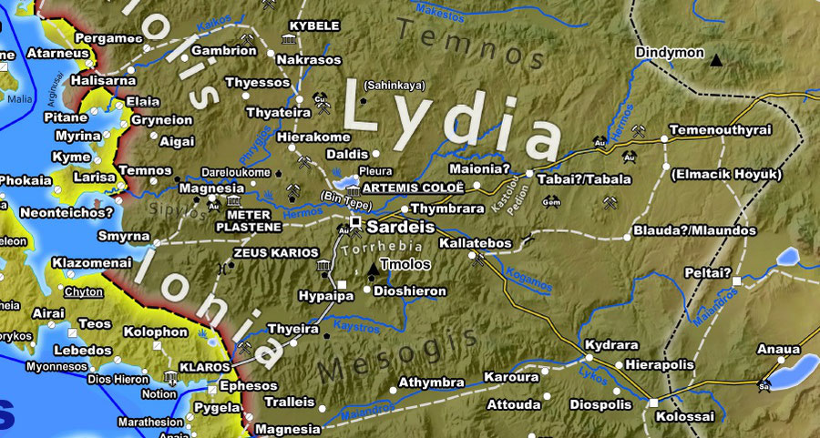
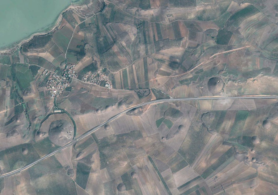
On example on the small slice of Classical Greece shown above is Bin Tepe (“thousand hills”), an extended tumuli cemetery used by the kings of Lydia and apparently also the Sardian (and local) upper classes with over 130 burial mounds. Bin Tepe is located at the southern shore of ancient lake Gyges, modern Marmara Gölü, opposite Sardis across the Hermos river. The burial mounds are well visible from Sardis itself, but that is unlikely the prime reason for the location of the cemetery. Quite possible that the Mermnad kings sought legitimacy by connecting to the past.
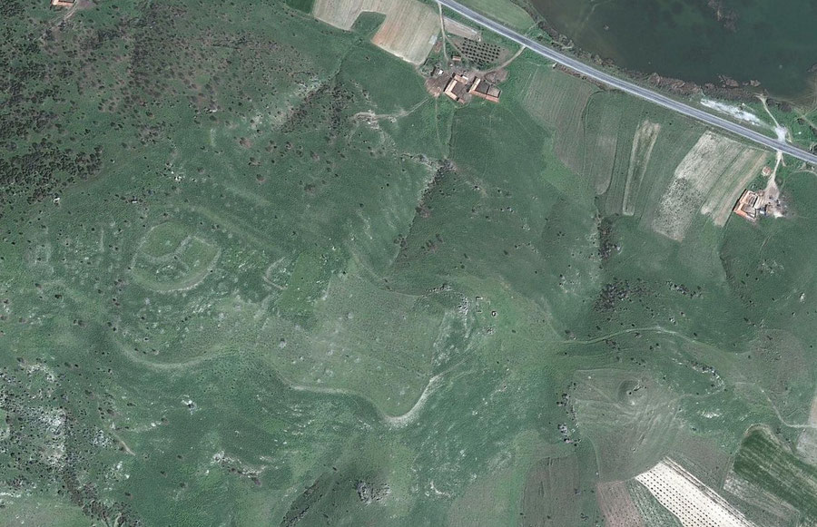
More recent archaeological research has revealed an extensive cluster of Bronze Age sites focused around the lake. The largest citadel, Kaymakçı, with evidence for a lower town in the plain, is only a few kilometers away from Bin Tepe. Perhaps, this was once Madunassa, a city mentioned in Hittite sources and probably the capital of the Seha River Land.
Clearly the classical era Lydians had some connection to the lake and apparently still remembered a now already mythical past, just as the Mycenaean World was not yet forgotten in Greece.
Write a comment